-
Climbing, Adventure, Gear & Choss


Hagerman Pass
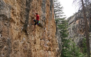
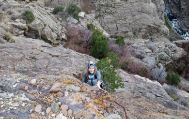
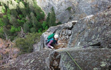
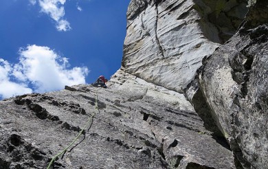
Hagerman Pass is a beautiful granite area offering both traditional and sport climbing. Situated between 9000′ and 10000′ feet, there are splitter cracks, run out slabs, big boulders, and awe inspiring views of the Frying Pan drainage. While some trad climbers have visited for years, most of the bolted climbing is less than five years old. Hell’s gate itself, a massive granite outcrop, is located near the Nast tunnel which pulls water destined for the Pacific over the continental divide and into front range water taps. The Hagerman pass road was originally a railroad corridor carrying people and goods from Leadville to Basalt. Basalt is the nearest town with amenities.
Hagerman pass is located between Leadville and Basalt, south of the Holy Cross Wilderness area. To reach from the Roaring Fork Valley drive north east from Basalt off of Hwy 82 along the Frying Pan Road, pass Ruedi Reservoir and Chapman Dam to where the pavement ends. Take a right just after the curve, which dead ends in about three miles at the gauging station. The granite is fairly obvious right off the road.
The Hell’s Gate Slab is visible from the Chapman Dam. It is a striking south facing four hundred+ foot ramp directly underneath the Hagerman Pass road. Bolted routes as well as trad lines ascend the sides and middle of the rock. There is a small cliff right off the road with some fun cracks that can be lead or TR’ed, and the formation lookers right of the slab holds at least one route, a beautiful short corner.
There are some bolted climbs at the end of the road at an area across the creek called the Miner’s Shack. There are also a handful of bolted routes if you go down to the Granite Lakes trailhead, down the trail and straight out left through the woods and over the creek. Right off the road above Hell’s Gate there are also some crack lines and a few more bolted routes.


Bulldog Creek Dog Walk (IV WI 4+)
Hayden Carpenter and Tom Bohanon recently repeated an obscure ice climb on the south side of Mt Sopris. Given a brief mention in Jack Robert’s ice guide, Bulldog Creek Walk is described as being 100 meters of WI 4. What they found was seven pitches of ice in a remote setting that makes for one […]


Recent Comments