-
Climbing, Adventure, Gear & Choss


The Choss Files, Retro-Edition – The Frying Pan
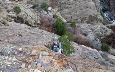
Ah the Frying Pan. This is one of my favorite crags, and it’s discovery was truly a privilege. After our success with the Narrows and Coal Creek, we were on a roll. It seemed as if the entire area was a blank canvas of undiscovered cliffs just waiting for us to poke our heads around the corner. It was with this optimism that Luke Laeser and I parked near the Reudi Dam one spring day in 2005 and started walking up hill.
The crag is obvious when you are coming down the road from the reservoir, and we figured others had surely gone before. Asking around, however, no one knew anything about it. We checked out the upper cliffs through binoculars, and could see what looked like good stone and even some splitter cracks. Alright!

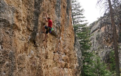
We left the car and just started going straight up the steep hill, passing a lower chossy crag along the way. We soon came to a boulder, and found that the rock was quite good! There wasn’t an abundance of holds, but it was solid. With this promising piece of info, we continued higher up the hill and soon came to the streaked walls of the Skillet. We could barely believe our eyes. Here was a crag that looked like a cross between Eldo and Mill Creek, and it was in our backyard! We walked along the walls, envisioning the lines. “That looks like a good warm up. That looks hard!” We moved up along the cliff, and were even more amazed as the walls continued to rise.
As we drove back to Carbondale that day we knew we had seen the future, and it was good. With the help of others, most notably Jeff Jackson and Josh Gross, it’s quickly become one of the top crags in the region. Look for full beta in the new Western Sloper guidebook, coming out in June.


Bulldog Creek Dog Walk (IV WI 4+)
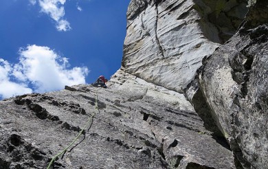
Hayden Carpenter and Tom Bohanon recently repeated an obscure ice climb on the south side of Mt Sopris. Given a brief mention in Jack Robert’s ice guide, Bulldog Creek Walk is described as being 100 meters of WI 4. What they found was seven pitches of ice in a remote setting that makes for one […]


One Response to The Choss Files, Retro-Edition – The Frying Pan